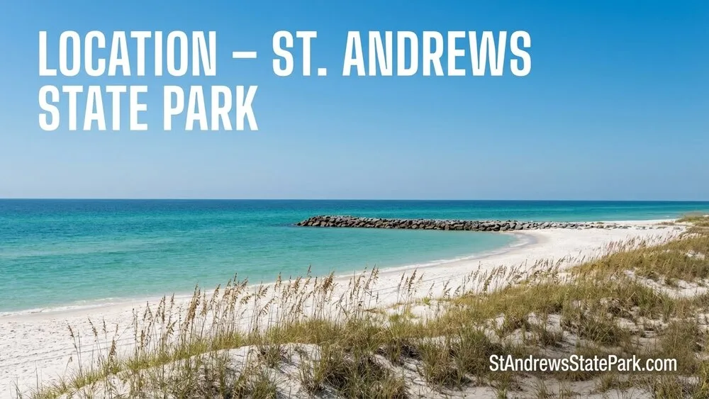
St. Andrews State Park works well for solo travelers because several very different coastal areas sit within one park entrance. You can stay near the active jetty Beach facilities, walk beside the open Gulf of Mexico, watch birds around Buttonbush Marsh, or take a boat to undeveloped Shell Island. The choice matters. Each area has a different level of water exposure, isolation, shade, facility access, and dependence on transportation schedules.
The park covers about 1,260 acres on a peninsula between the Gulf of Mexico, St. Andrew Bay, and Grand Lagoon. Its official brochure describes more than 1.5 miles of beach, while the approved management plan counts roughly 4.6 miles of Gulf shoreline across the full park unit, including the large Shell Island section.[a] For someone visiting alone, that geography creates plenty of choice without requiring a long drive between activities.
📍 A Practical Starting Point
Jetty Beach is the easiest area to manage on a first solo visit. Parking, restrooms, beach access, concessions, the inlet lagoon, and the open Gulf shore sit within the same general zone. It lets you study the conditions before deciding whether to swim, snorkel, walk, or remain on shore.
Know the Park’s Four Solo-Travel Areas
St. Andrews is not one continuous visitor area. The park works more like a small coastal district, with separate zones connected by the main park road. Understanding those zones before parking prevents wasted walking and makes it easier to keep a clear return route.
| Area | Works Well For | Facility Access | Water Exposure | Solo-Travel Consideration |
|---|---|---|---|---|
| Jetty Beach | First visits, short swims, snorkeling, beach time | High | Protected inlet side and open Gulf side | Choose the correct side of the jetty for the day’s conditions |
| Gulf Beach | Walking, sunbathing, surf watching, sunsets | Moderate near access points | Open surf | Track walking distance and beach flags |
| Grand Lagoon | Fishing, picnicking, marina activity, short visits | High | Bay and lagoon water | Stay clear of boat-launch and navigation areas |
| Gator Lake and Marshes | Birding, short walks, nature observation | Limited | Freshwater wetlands | Use overlooks and marked paths |
| Shell Island | Long beach walks, quiet shore time, nature viewing | None at the ferry landing area | Bay and Gulf shorelines | Return transportation and supplies must be settled before departure |
Jetty Beach and the Inlet Lagoon
The jetty divides two very different water settings. On one side sits the shallow inlet lagoon, often called the protected pool. On the other lies the open Gulf beach, where waves and surf currents have more influence. The two areas may be only a short walk apart, yet they should never be treated as interchangeable.
The official park map places bathhouses, concessions, picnic shelters, parking, beach walkways, and the Gun Mount Pavilion around this part of the peninsula.[d] That concentration of services makes the jetty area useful when visiting alone. Food, water, shade, and the vehicle remain within a manageable distance.
The protected pool can feel calmer than the Gulf shore, especially when surf builds outside the rocks. Calm-looking water still deserves a pause before entry. Tidal movement, changing depth, marine life, and currents near the pass do not disappear because waves look small.
The Open Gulf Beach
The Gulf side suits travelers who want room to walk, sit, read, or watch the sunset without boarding a boat. Boardwalks cross the dunes from the parking areas, and the beach spreads far enough for visitors to find space beyond the busiest access points.
Easy to overlook, the return distance matters more than the outward distance. A relaxed shoreline walk can place you far from the correct boardwalk before the heat, changing weather, or approaching sundown becomes noticeable. Photograph the beach-access marker or save the vehicle location before walking away.
The open beach also receives the full effect of surf conditions. A warm, sunny afternoon does not guarantee comfortable swimming water. For solo travelers, the Gulf shore works best when swimming remains optional rather than the only reason for visiting.
Grand Lagoon and the Pier Area
Grand Lagoon has a different character. The management plan identifies a boat ramp, fishing pier, picnic facilities, restrooms, tour-boat dock, and concession services within the Lagoon Use Area.[c] It suits visitors who prefer to spend time beside the water without entering open Gulf surf.
The marina and boat ramp create regular vessel movement. Swimming areas, fishing areas, and navigation routes should remain separate. A solo visitor can use the pier, picnic area, or shoreline views while keeping clear of launch lanes and working docks.
Grand Lagoon also makes a useful lower-commitment stop. You can remain close to parking and facilities, watch boats cross toward St. Andrew Bay, then decide whether there is enough time for another park area.
Gator Lake and Buttonbush Marsh
The park’s interior wetlands provide a quieter alternative to the beach. The approved management plan lists the 0.6-mile Gator Lake Trail, the 1-mile Heron Pond Trail, a Gator Lake overlook, and a Buttonbush Marsh overlook. These areas support wading birds, waterfowl, wetland plants, and other wildlife.
The lake and marsh are observation areas, not places to approach the waterline. Use the overlooks, remain on marked routes, and leave space around any animal. Binoculars or a camera with moderate zoom are more useful here than moving closer.
For a traveler who does not plan to swim, these wetlands give the visit a clear purpose. They also offer solitude without the transport dependence of Shell Island.
Shell Island
Shell Island forms most of the park’s undeveloped Gulf shoreline. The 2016 management plan estimates that roughly three quarters of the park’s Gulf beach lies on the island. Apart from limited docks and boardwalk access around designated landing areas, the park portion remains undeveloped.
That lack of development is the appeal. It is also the main planning difference. There are no restrooms, food services, or dependable shade at the ferry destination. Once the boat leaves, returning to the vehicle is no longer a short walk.
Choose the Area Before Choosing the Activity
A solo traveler may arrive thinking only about swimming or snorkeling. A better decision starts with the location. Which shoreline are you entering? How far will the car be? Is the return controlled by your own timing or by a ferry?
For a First Visit
Begin around Jetty Beach. The area provides several choices within a compact space. You can inspect the inlet lagoon, walk to the Gulf side, locate the bathhouse, note the parking area, and watch the water before committing to an activity.
This does not make the jetty universally safer than every other part of the park. It makes the visit easier to adjust. If the Gulf surf looks uncomfortable, the day can shift toward the beach, pavilion, lagoon-side observation, or an inland walk.
For Quiet Time Near Facilities
The mainland Gulf beach offers more personal space without separating you from the park road. Stay within a reasonable walk of a marked crossover, especially during hot weather or late afternoon. Quiet does not require complete isolation.
For Wildlife Observation
Gator Lake and Buttonbush Marsh fit birdwatching, photography, and slow walking. The wetlands hold water through much of the year, and seasonal conditions change which birds appear. Morning usually provides cooler walking conditions and more active bird movement.
For the Most Seclusion
Shell Island offers the greatest separation from the mainland visitor areas. It suits someone comfortable carrying all supplies and managing a fixed pickup time. It is a poor match for a late arrival, a nearly empty phone battery, or a plan that depends on frequent access to shade and restrooms.
Water Safety Changes by Shoreline
The Gulf side, inlet lagoon, pass, bay, and freshwater wetlands each behave differently. Advice that fits one setting may not fit another. The most useful habit is simple: observe the specific water in front of you rather than relying on how it looked during an earlier visit.
Read the Beach Flags Before Entering the Gulf
Bay County uses a color-coded warning system for Gulf conditions. Green indicates a lower hazard, yellow marks moderate surf or currents, one red flag warns of high surf or strong currents, and double red flags mean the Gulf is closed to public entry. Purple warns of potentially hazardous marine life.[h]
A green flag does not mean zero risk. Conditions can vary along the shore, and flags may change as wind, waves, or distant swell changes. Check the posted flag after entering the park, not only before leaving your accommodation.
🌊 Open-Water Rule for Solo Visitors
When the flag, surf, or current gives you doubts, remain on shore. There is no need to “test” the water by swimming farther. The park still offers beach walking, wildlife overlooks, fishing areas, pavilions, and Grand Lagoon views.
Understand Rip Currents
A rip current is a narrow stream of water moving away from shore through the surf zone. The National Weather Service notes that rip currents often form near breaks in sandbars and around structures such as jetties, inlets, reefs, and piers. They may occur on bright days when the beach weather appears pleasant.
Typical rip currents move around 1 to 2 feet per second, but measured speeds can reach about 8 feet per second—faster than a person can outswim directly against the flow.[g] The current carries a swimmer away from the beach; it does not normally pull the swimmer beneath the surface.
Look from the boardwalk or dune crossover before descending to the water. Possible signs include a darker channel, an area where waves break less often, or foam and floating material moving seaward. These signs are not always easy to see. When uncertain, stay out.
If a Current Carries You Away
- Do not exhaust yourself by swimming straight against the flow.
- Float or tread water while regaining control of your breathing.
- Move parallel to the beach when an escape route becomes available.
- Wave and call for help.
- Return toward shore after moving beyond the narrow current.
Treat the Inlet Lagoon as Natural Water
The shallow pool behind the jetty is more sheltered from direct Gulf surf, making it popular for wading and snorkeling. Sheltered is the accurate word. Controlled is not.
Watch for changes in depth, tidal movement, slippery surfaces, shells, rocks, and marine animals. Keep the first swim close to shore, especially when visiting alone. A mask can narrow awareness, so lift your head regularly and check your position against a fixed object on land.
Keep Distance From the Jetty Rocks
Granite jetty rocks create habitat for fish and make the area appealing for snorkeling and fishing. They also have uneven gaps, hard edges, and surfaces that become slick when wet. Waves can change the safe standing area within seconds.
Remain on stable, permitted surfaces and avoid stepping between rocks. Do not use the jetty as an entry point when waves are washing across it. Enter the water from a suitable beach area instead.
Use a Conservative Swimming Boundary
Solo swimming calls for a smaller boundary than swimming with a capable companion. Stay where returning to shore requires little effort. Keep one fixed landmark in view and leave the water as soon as repeated correction is needed to hold your position.
- Check the posted flag and local surf forecast.
- Observe the water for several minutes from an elevated access point.
- Choose a clear entry and exit area.
- Keep the phone and vehicle key in a properly sealed container.
- Leave the water before fatigue, chills, glare, or changing weather affects judgment.
Time the Visit Around Light, Heat, and Return Access
St. Andrews State Park opens at 8 a.m. and closes at sundown, 365 days a year. Current admission is $4 for a single-occupant vehicle, $8 for a vehicle carrying two to eight people, and $2 for pedestrians or bicyclists.[b]
The closing time moves with sunset rather than staying at one fixed hour. That matters during winter, when the available afternoon is shorter. Day-use visitors should be back near their vehicles before sundown rather than beginning the return walk at sundown.
Opening Time to Mid-Morning
Early hours suit a first solo visit. Temperatures are usually lower, the remaining daylight is easy to judge, and there is enough time to learn the road layout without rushing. Wildlife observation also fits this period well, particularly around Gator Lake and Buttonbush Marsh.
Arriving near opening also leaves room to change plans. A rough Gulf can lead to an inland walk. A warm, calm morning can shift toward the jetty area. A Shell Island trip remains possible only after checking that day’s ferry operation.
Late Morning
Late morning often provides the broadest choice of services and activities. Concession areas operate, ferry departures may be underway, and there is still enough daylight for a measured visit.
Sun exposure rises quickly on white sand. The sand reflects light upward as well as receiving it from above, so a beach umbrella does not replace sunscreen, drinking water, and eye protection.
Midday and Early Afternoon
This period can feel much hotter than the air-temperature number suggests. Walking through deep sand uses more energy, and long stretches of the Gulf beach offer little natural shade. Choose the turnaround point before feeling tired.
The wetlands may also feel still and humid during midday. A shorter observation stop can make more sense than combining both trails under strong sun. Water first, distance second.
Late Afternoon to Sundown
Late afternoon fits beach walking, photography, and Gulf views. It does not leave much room for navigation mistakes. Mark the correct boardwalk and begin returning while the access route remains easy to see.
A late arrival should remain on the mainland. Starting a ferry-dependent or extended trail visit near the end of the day adds deadlines without improving the experience.
Treat Shell Island as a Separate Excursion
Shell Island is accessible only by boat. The official park ferry operates from the marina side of St. Andrews, with tram transport beginning near the Pier Store. Service depends on weather and seasonal operations.[e]
As of July 2026, the concessionaire lists Tuesday-through-Sunday outbound departures at 10 a.m., 11 a.m., noon, 1 p.m., and 2 p.m., with a final island pickup at 4 p.m. The crossing takes about 15 minutes, and the drop-off sits roughly 2.2 miles down the island at the state park docks rather than behind Jetty Beach.[f]
Schedules can change with season, holidays, weather, and operating needs. Confirm both the departure and final pickup before buying supplies or leaving the mainland. A screenshot of the current schedule is useful when phone reception or battery power is limited.
What Changes After Boarding
- The vehicle is no longer within walking distance.
- Restrooms, shops, and food service are not available at the island destination.
- Natural shade is limited and cannot be counted on.
- The return depends on boat operations and pickup time.
- Walking farther along the shore increases the distance back to the dock.
- Weather changes may shorten the useful part of the visit.
Supplies for a Solo Island Visit
Carry enough drinking water for the entire stay, not merely the crossing. Add sun protection, simple food, a compact shade option where permitted, a charged phone, and a waterproof bag. Pack lightly enough to carry everything back without leaving items on the beach.
Keep the dock location visible or recorded before walking away. A long, uniform shoreline can make the return point less obvious than expected, especially after several hours of walking and swimming.
When the Mainland Is the Better Choice
Remain on the mainland when arriving late, when the final pickup feels restrictive, or when regular access to restrooms and shade matters. The same applies when ferry operation is uncertain or Gulf conditions may change during the afternoon.
Skipping the island does not reduce the park to a brief beach stop. Jetty Beach, Grand Lagoon, Gator Lake, Heron Pond, Buttonbush Marsh, and the mainland Gulf shore can fill several hours without a boat schedule.
Walk the Wetland Areas With Clear Boundaries
Gator Lake and Buttonbush Marsh allow close viewing of Florida coastal wetland habitat without entering the water. The park plan identifies basin marshes, wet flatwoods, coastal scrub, dunes, pine communities, and other natural communities across the unit.
Use the Overlooks
The overlooks provide the intended viewing points. Wildlife may include alligators, herons, egrets, grebes, ducks, and other water-associated species. Remain behind barriers, give animals a wide path, and avoid stepping toward the water for a clearer photograph.
Never feed wildlife. Feeding changes natural behavior and encourages animals to approach visitor areas. Food should remain sealed, and scraps should leave with you or go into the correct waste container.
Keep Your Hearing Available
Listening to music can make a quiet walk pleasant, but both ears should not be fully blocked. Bikes, other visitors, weather, and wildlife can approach before they enter your direct line of sight. Low volume or one open ear keeps the surroundings readable.
Stay on the Marked Route
Wetlands change with rainfall and season. Ground that looks dry may be soft or waterlogged below the surface. Marked trails and overlooks protect both the visitor and the habitat, while dune and marsh shortcuts offer little benefit.
Record the Parking Area and Return Route
The park’s approved plan describes two beach-use parking areas, a separate lagoon area, roadside spaces near wetland overlooks, campground loops, and support zones. Similar-looking roads and dune crossovers can blur together after a long beach walk.
Save More Than a Map Pin
A phone map pin helps, but a visible landmark is better when GPS accuracy shifts near the shore. Photograph the nearest pavilion, bathhouse, crossover number, or parking sign. Note whether the vehicle sits near the jetty, pier side, lagoon, or an inland overlook.
Download or screenshot the park map before entering. The map labels the entrance station, Jetty Use Area, Gulf-side facilities, Gator Lake, Grand Lagoon, trails, fishing piers, tour-boat dock, and Shell Island landing areas.
Set a Turnaround Time
A turnaround time is more useful than a distance target. The return may take longer because of heat, soft sand, photo stops, or an incoming breeze. On the Gulf beach, turn back while at least half of the comfortable walking time remains.
For Shell Island, the boat schedule replaces the normal turnaround rule. Aim to reach the dock well before pickup, not at the stated minute.
Change Areas When Conditions Change
A useful solo visit remains flexible. Water, wind, heat, visibility, and transport schedules can change after entering the park. Switching areas is often the sensible choice, not a failed plan.
When the Gulf Is Rough
Stay out of open surf and use the shoreline for walking or observation. Grand Lagoon, the picnic areas, Gator Lake, Buttonbush Marsh, and the park’s inland routes remain available. The protected inlet side may look calmer, but posted restrictions and local conditions still apply.
When the Ferry Does Not Fit
Use the mainland beach and jetty area instead of rushing to make a departure. A shortened island visit leaves less time to learn the dock layout, find a comfortable place, and return without watching the clock.
When Afternoon Weather Builds
Leave the water and open beach when thunder is heard or lightning is visible. Move toward a proper enclosed shelter or vehicle rather than waiting beneath an umbrella, pavilion edge, or isolated tree. Resume outdoor activity only after conditions have clearly moved away.
When Energy Drops
Heat fatigue can arrive gradually. A headache, unusual weakness, dizziness, or difficulty concentrating means the walking or swimming portion should end. Move to shade, drink water, and return toward facilities. Shorter, then, is better.
Match the Area to Your Comfort Level
| Visitor Preference | Most Suitable Area | Reason |
|---|---|---|
| First solo park visit | Jetty Beach | Several activities and facilities within one compact area |
| Quiet beach time with a simple return | Mainland Gulf Beach | More space without ferry dependence |
| No swimming planned | Gator Lake, Buttonbush Marsh, or Grand Lagoon | Wildlife, walking, fishing, and water views from land |
| Short visit | Jetty or Grand Lagoon | Parking and facilities stay close |
| Maximum seclusion | Shell Island | Undeveloped shoreline and fewer mainland services |
| Late-afternoon arrival | Mainland Beach or Lagoon Area | No boat return and a clearer route back before sundown |
For most first-time solo travelers, the jetty and mainland areas provide the most adaptable visit. Shell Island suits a different kind of day—one with an early start, confirmed transportation, enough supplies, and comfort with an undeveloped setting. The park does not require taking the most isolated option to find quiet space.
Frequently Asked Questions
Is St. Andrews State Park Suitable for Solo Travelers?
Yes. The park has mainland beaches, restrooms, concessions, picnic areas, short nature trails, wetland overlooks, fishing areas, and boat access. Solo visitors should select an area based on water conditions, remaining daylight, facility needs, and return access.
Which Area Is Easiest for a First Solo Visit?
Jetty Beach is the easiest starting area because parking, restrooms, concessions, the inlet lagoon, and the open Gulf shore sit within the same general zone. It allows the visit to change without relocating far across the park.
Can a Solo Traveler Visit Shell Island?
Yes, provided the visitor confirms the ferry schedule, carries enough water and sun protection, records the dock location, and returns before the final pickup. The island destination has no restrooms, dependable shade, or food service.
Where Can I Go Without Entering the Water?
Gator Lake, Buttonbush Marsh, Heron Pond Trail, the Grand Lagoon fishing pier, picnic areas, pavilions, and the Gulf beach all provide land-based activities. Wildlife viewing and shoreline walking can fill a visit without swimming.
What Time Should a Solo Visitor Arrive?
Arrival near the 8 a.m. opening gives the most flexibility, cooler walking conditions, and enough daylight to change areas. Late arrivals are better suited to the mainland beach, jetty, or Grand Lagoon rather than a ferry-dependent visit.
Is the Protected Pool Behind the Jetty Always Calm?
No. It is more sheltered from direct Gulf surf, but it remains natural coastal water affected by tide, depth changes, currents, weather, rocks, and marine life. Observe the water and follow all posted instructions before entering.
Sources and Footnotes
- [a] Florida State Parks — St. Andrews State Park: Official park overview covering location, operating hours, beaches, landscapes, and visitor activities. (Reliable because it is maintained by the Florida State Parks system.) View the official park page.
- [b] Florida State Parks — Hours and Fees: Current entrance charges for single-occupant vehicles, standard vehicles, pedestrians, bicyclists, and boat-launch users. (Reliable because it is the park system’s official fee page.) View hours and admission fees.
- [c] Florida Department of Environmental Protection — Approved Unit Management Plan: Details the park’s visitor zones, shoreline, trails, wetlands, facilities, natural communities, and Shell Island land-use structure. (Reliable because it is an approved state land-management document.) Read the approved management plan.
- [d] Florida State Parks — Official Park Map and Brochure: Shows beach-use areas, bathhouses, concessions, trails, Gator Lake, Grand Lagoon, fishing piers, parking, and Shell Island. (Reliable because it is the official visitor map issued for the park.) Open the official park map.
- [e] Florida State Parks — Experiences and Amenities: Describes official ferry access, boat operations, camping, and other visitor services, including the weather-dependent nature of boat service. (Reliable because it is maintained by Florida State Parks.) View park experiences and services.
- [f] Official Shell Island Ferry Concessionaire: Provides the current listed departure schedule, final pickup time, crossing length, landing location, and lack of island facilities. (Reliable for operational details because it is the park’s designated ferry operator.) Check the current ferry information.
- [g] National Weather Service Tallahassee — Rip Current Awareness: Explains rip-current formation, warning signs, measured speeds, jetty-related risk, and escape actions. (Reliable because the National Weather Service is the federal weather authority for the region.) Read the NWS rip-current information.
- [h] Bay County — Beach Safety Flags: Defines the official Gulf beach warning colors and the restrictions associated with elevated hazards. (Reliable because it is the official Bay County public-safety resource.) View the beach flag meanings.