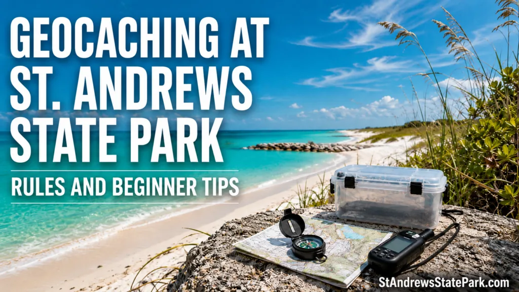
Geocaching at St. Andrews State Park looks simple on a phone: choose a listing, follow the coordinates, and sign the log. The coastal setting adds another layer. A cache may sit near pine flatwoods, a lake overlook, dune vegetation, a historic feature, or a busy day-use area, so the safest route is not always the shortest line on the screen. Coordinates identify a destination; they do not grant access through every patch of land between you and it.
The park officially lists Geo-Seeking among its visitor experiences and describes geocaching as an activity that should leave very little impact on the environment. The same park page points visitors toward the Operation Recreation GeoTour.[b] For a beginner, that makes St. Andrews an inviting place to learn—provided the search stays on open routes and respects the landscape.
🧭 One rule separates two very different activities: finding an already published cache does not require the same approval as placing a new one. Hiding a cache inside a Florida State Park requires advance permission from the park manager.
Can You Geocache at St. Andrews State Park?
Yes. Geocaching is a recognized park activity, but it operates inside the same boundaries that apply to hiking, wildlife viewing, historic resources, and protected habitat. An active cache listing does not override a closure sign, rope line, boardwalk boundary, construction barrier, or instruction from park staff.
The park opens at 8 a.m. and closes at sundown every day of the year. The current admission schedule lists $8 for a vehicle carrying two to eight people, $4 for a single-occupant vehicle, and $2 for pedestrians or bicyclists.[c] Since sundown changes through the year, an afternoon search needs more time than the map distance alone suggests.
| Park Detail | What It Means for a Cache Search |
|---|---|
| Open 8 a.m. to sundown | Start early enough to finish the search and return to the parking area before closing. |
| Paid entrance | Park admission applies even when the visit is mainly for geocaching. |
| Geo-Seeking is listed as an activity | Searches are welcome when they follow park rules and low-impact practices. |
| Temporary notices may appear | On-site signs and current park notices take priority over an older cache description. |
Finding a Cache and Placing One Follow Different Rules
Searching for an existing listing usually means navigating to a location already reviewed through the geocaching publication process. Placing a container changes the site, even when the box is small. That is why Florida State Parks requires anyone planning to hide a cache or letterbox to contact the park manager beforehand and receive permission.[a]
| Situation | Park-Safe Response |
|---|---|
| Searching for an active published cache | Use visitor-accessible routes and follow the listing without disturbing the site. |
| Planning to place a new cache | Ask the park manager for permission before choosing or preparing a hiding place. |
| Coordinates appear inside a dune or sensitive area | Do not cross the boundary. Recheck the listing, approach route, and recent logs. |
| A hiding place seems to require digging | Do not dig or bury a container. |
| A historic object appears near ground zero | Leave it in place and avoid using it as cache camouflage. |
| A container needs trade items | Use clean, non-food items. Do not place batteries, lighters, matches, aerosols, or other restricted materials inside. |
Rules for a New Cache Location
- Do not bury the container or dig a hole for it.
- Avoid dunes, archaeological areas, historic sites, and active prescribed-fire zones.
- Do not cut, bend, remove, or rearrange native plants to create camouflage.
- Do not attach a cache in a way that harms bark, structures, signs, or park fixtures.
- Keep food and scented items out of the container because wildlife may tear it apart.
- Plan for maintenance. A hidden cache still needs an owner who can replace a wet log, repair the container, or remove it when requested.
📍 Permission is about the location, not only the box. A harmless container can still draw repeated foot traffic into a dune edge, nesting area, restoration plot, or cultural site.
Why the GPS Arrow Does Not Choose Your Route
A phone may show the cache 300 feet away while the legal approach bends around a lake, follows a boardwalk, or begins from another parking area. That curve is not wasted distance. It is the route that keeps the search inside the public-use network.
The 2016 approved management plan recorded St. Andrews State Park at 1,167 acres and described land on both the mainland and Shell Island. It also identified a mix of estuarine tidal marsh, freshwater depression marsh, scrub, maritime hammock, beach dune, and rare coastal dune lakes.[d] Those habitats explain why a straight-line approach can be a poor choice even when the terrain looks open.
Dunes
Dune vegetation may look sparse, but its roots hold shifting sand in place. Stay on boardwalks, signed paths, and established access points. If the arrow points across a roped or fenced dune, stop. A legitimate cache should not require crossing a protected boundary.
Wetlands and Lake Edges
Water levels, soft ground, and vegetation can make a coordinate appear closer than the usable approach really is. Do not step into marsh plants or leave an overlook to shorten the route. The safe approach may end before the distance counter reaches zero.
Pine Flatwoods and Scrub
In wooded sections, GPS accuracy can drift as the phone moves under tree cover. Slow down rather than widening the search. Do not break branches, pull palmetto fronds, peel bark, or create a new side trail. If a rock or loose natural object is lifted, return it to the same position.
Choosing a Beginner-Friendly Cache
The first listing should reduce guesswork. A low difficulty rating, low terrain rating, recent successful logs, and a clear cache size give a beginner more useful information than a large number of favorite points alone.
Start With the Cache Type
| Cache Type | What You Are Looking For | Beginner Note |
|---|---|---|
| Traditional Cache | A physical container with a log sheet at the posted coordinates. | Usually the clearest first choice because the posted point is the container location. |
| Multi-Cache | One or more stages that lead to a final physical container. | Read every stage before starting; the first coordinate is not normally the final box. |
| Mystery or Puzzle Cache | A puzzle, field task, or special step that reveals the final coordinates. | Do not assume the posted point is where the container sits. |
| EarthCache | A location-based geology lesson with observation questions rather than a standard container. | Read the logging tasks before visiting and expect to study the site instead of signing a paper log. |
Geocaching HQ defines a Traditional Cache as a container with a log sheet at the posted coordinates. An EarthCache uses on-site geological observations and questions, so it may have no physical box at all.[e] This distinction matters around a coastal park where rock, sand, shoreline processes, and historic structures can all look like possible hiding places.
Read the Recent Logs
Recent logs tell you whether the container was found, whether the logbook was wet, whether coordinates seemed accurate, and whether access conditions changed. One “did not find” entry proves little. Several in a row, especially after storms or maintenance work, suggest the cache may need attention.
Check Difficulty, Terrain, Size, and Attributes
- Difficulty reflects the mental challenge, camouflage, and search effort.
- Terrain reflects the physical approach, though heat, loose sand, and humidity can make a short route feel harder.
- Container size changes what your eyes should search for; a micro can be smaller than expected.
- Attributes may note parking, restrooms, fees, children, pets, or other access details.
For a first attempt, choose one listing with recent finds and a straightforward approach. Two well-chosen searches teach more than six rushed ones.
Heron Pond and Gator Lake
St. Andrews has two named nature trails, and each is about half a mile long. Heron Pond Trail passes through flatwood pine forest toward Sandy Point, while Gator Lake Trail follows a scenic lakeside setting.[b] A cache listing near either trail should be approached from the trail network, not from a direct line across vegetation.
Heron Pond Trail
Pine trunks, palmetto, fallen material, and repeating vegetation can make visual searching slow. Pause before leaving the trail edge. Compare the cache size and hint with the objects already visible. If the only apparent approach would flatten plants, the search area needs to be reconsidered.
Gator Lake Trail
The Gator Lake Trail and overlook are known wildlife-viewing points for alligators, waterfowl, wading birds, and smaller animals. Remain on the visitor route and give wildlife space. A coordinate never justifies moving closer to the waterline or stepping around a viewing barrier.
🐊 If an alligator or another animal is near the approach, wait at a distance or leave the cache for another time. Do not feed wildlife, call it closer, or position yourself between an animal and the water.
Handling the Final 30 Feet
The last few yards cause most beginner frustration. The arrow swings. The distance changes. Nearby trees, structures, and phone movement can push the reading in different directions. At that point, observation matters more than walking faster.
- Stop and let the GPS reading settle for several seconds.
- Confirm the cache size, difficulty, terrain rating, and hint.
- Look for objects that seem slightly out of place without moving anything yet.
- Search with your eyes before using your hands.
- Never place a hand blindly inside a hole, thick vegetation, pipe, or rock gap.
- Use the lift-look-replace method only on loose objects that can be moved safely.
- Return every object and the cache container to the position in which it was found.
- End the search if finding it would require damage, digging, climbing a closed structure, or entering a restricted area.
GPS accuracy is not a promise that the container sits under the exact number shown on the screen. Search patterns should stay small and deliberate. Wider is not always better.
Wildlife and Natural Objects Are Not Cache Props
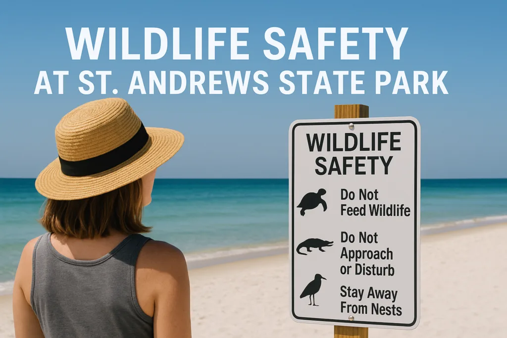
St. Andrews supports birds, deer, raccoons, reptiles, and many smaller animals. The approved management plan also identifies protected habitat for shorebirds, sea turtles, and other wildlife. That makes low-impact searching part of the activity, not an optional extra.
- Do not move eggs, nests, feathers, shells occupied by animals, or wildlife remains.
- Do not use food as a trade item or place anything scented inside a cache.
- Step away when birds repeatedly alarm, circle, or defend a patch of ground.
- Leave rocks, historic fragments, and natural objects where they are.
- Keep noise low around overlooks and wildlife-viewing areas.
- Wash mud and plant material from shoes and gear after the visit to reduce the spread of invasive species.
A cache owner may use artificial camouflage that resembles bark, stone, or a utility object. A visitor still should not dismantle park property to test a guess. When in doubt, leave it alone and review the hint.
What to Carry for a Short Search
St. Andrews combines sun, humidity, loose sand, insects, and areas where phone reception may feel less reliable than expected. A small field kit keeps the visit comfortable without turning it into an expedition.
Navigation
- Charged phone or GPS unit
- Offline cache details and recent logs
- Park map
- Portable battery
- Pen or pencil
Comfort and Site Care
- Drinking water
- Sun protection
- Insect repellent
- Closed-toe shoes
- Basic first-aid supplies
- Small bag for litter
Download the listing before entering the search area. The cache description, hint, attributes, and recent logs are more useful than a bare coordinate when the phone signal changes.
What to Do After You Find the Cache
- Open the container carefully and keep every loose item together.
- Sign the paper log with your geocaching name and the date.
- Trade only when you can leave an appropriate clean item of similar or greater value.
- Do not take a trackable item unless you understand how to log and move it.
- Close the container fully so rain and humidity stay out.
- Return it to the same location and orientation.
- Restore the light camouflage exactly as it appeared.
- Post an online log that helps the owner without revealing the hiding place.
If the logbook is wet, the lid is broken, or the cache appears displaced, note the condition in the online log. Do not replace a missing cache with a new container unless you are its owner or have clear authorization from the owner and park staff.
When a DNF Is the Right Log
“Did Not Find” is a normal geocaching log. It tells the owner what happened and may help reveal a maintenance problem. More important, it gives the searcher permission to stop before curiosity turns into site damage.
- The park is nearing sundown.
- The apparent route crosses dunes, wetlands, restoration areas, or closed ground.
- Wildlife is occupying the approach.
- Weather conditions make the return walk uncertain.
- The listing shows several recent unsuccessful searches.
- The search would require digging, prying, breaking, climbing, or dismantling.
- A current sign conflicts with the cache description.
As of July 2026, the official amenities page notes ongoing construction in part of the campground and tells visitors not to enter the construction zone.[b] The specific work area may change, but the rule does not: current park directions outrank cached map data and old listing notes.
Geocaching With Children and Pets
Children
Children can help read the distance, compare clues, spot artificial camouflage, and sign the log. Adults should handle any search involving rock gaps, thick vegetation, sharp edges, or areas beside water. A small traditional container with a clear hint usually works better than a difficult micro for a first family search.
Pets
Pets at St. Andrews must remain well behaved and on a 6-foot leash. They may be walked in picnic areas and along bike and hiking trails, but they are not allowed on the beach, in wetlands, on boardwalks, in playgrounds, or inside buildings. Service animals are exempt from those location restrictions.[b]
🐕 A “dogs allowed” cache attribute does not replace the park’s area-specific pet rules. Check the whole approach, not only the final coordinates.
Mistakes That Cause Trouble at This Park
- Following the arrow across dunes instead of using the established access route.
- Assuming every cache has a physical container.
- Ignoring the last several online logs.
- Starting near sundown without allowing time for the walk back.
- Searching inside a closed, fenced, or active work area.
- Placing a new container without park approval.
- Digging because the cache “must be buried.”
- Moving plants, historic material, or park fixtures to test possible hiding spots.
- Leaving food, batteries, or scented trade items in the container.
- Taking a trackable object as a souvenir without logging it.
- Continuing to search when wildlife blocks the approach.
- Replacing a supposedly missing cache without authorization.
The cleanest search leaves almost no evidence that it happened. The container goes back as found, the trail edge stays intact, wildlife keeps its distance, and the next visitor gets the same puzzle. Found or not found, that is a successful visit.
Sources
- Florida State Parks — Location-Based Experiences — Rules for cache placement, manager permission, sensitive areas, prohibited contents, and low-impact search practices. (Official Florida Department of Environmental Protection park-system guidance.)
- Florida State Parks — St. Andrews Experiences & Amenities — Geo-Seeking, Heron Pond and Gator Lake trails, wildlife viewing, pet restrictions, and current site notices. (Official park page maintained by Florida State Parks.)
- Florida State Parks — St. Andrews Hours & Fees — Operating hours and current admission categories. (Official park information page.)
- Florida Department of Environmental Protection — St. Andrews State Park Approved Unit Management Plan — Recorded acreage, park geography, natural communities, wildlife habitat, and cultural resources. (Approved state management document.)
- Geocaching HQ — Geocache Types — Definitions of Traditional, Multi, Mystery, and EarthCache listings. (Official record platform and rule authority for Geocaching listings.)
Frequently Asked Questions
Is geocaching allowed at St. Andrews State Park?
Yes. The park lists Geo-Seeking as a visitor experience. Searches must stay in public-access areas and follow current signs, closures, habitat protections, and park staff instructions.
Do I need permission to find an existing cache?
A visitor does not normally need separate park-manager approval to search for an active published cache. Regular admission, park hours, area restrictions, and posted rules still apply.
Do I need permission to hide a cache in the park?
Yes. Florida State Parks requires advance permission from the park manager before a cache or letterbox is placed.
Can a geocache be buried at St. Andrews State Park?
No. Digging holes and burying caches are not permitted in Florida State Parks.
What should I do when coordinates point into dunes or a closed area?
Do not enter. Recheck the approach, listing details, and recent logs. Park signs and closures take priority over the route shown by a phone or GPS unit.
Does every geocache have a physical container?
No. Traditional Caches use a container and log sheet, while EarthCaches rely on geological observations and logging questions rather than a standard hidden box.
Can I bring a dog while geocaching?
Dogs may use permitted picnic areas and hiking or bike trails while on a 6-foot leash. Pets are not allowed on the beach, in wetlands, on boardwalks, in playgrounds, or inside park buildings.