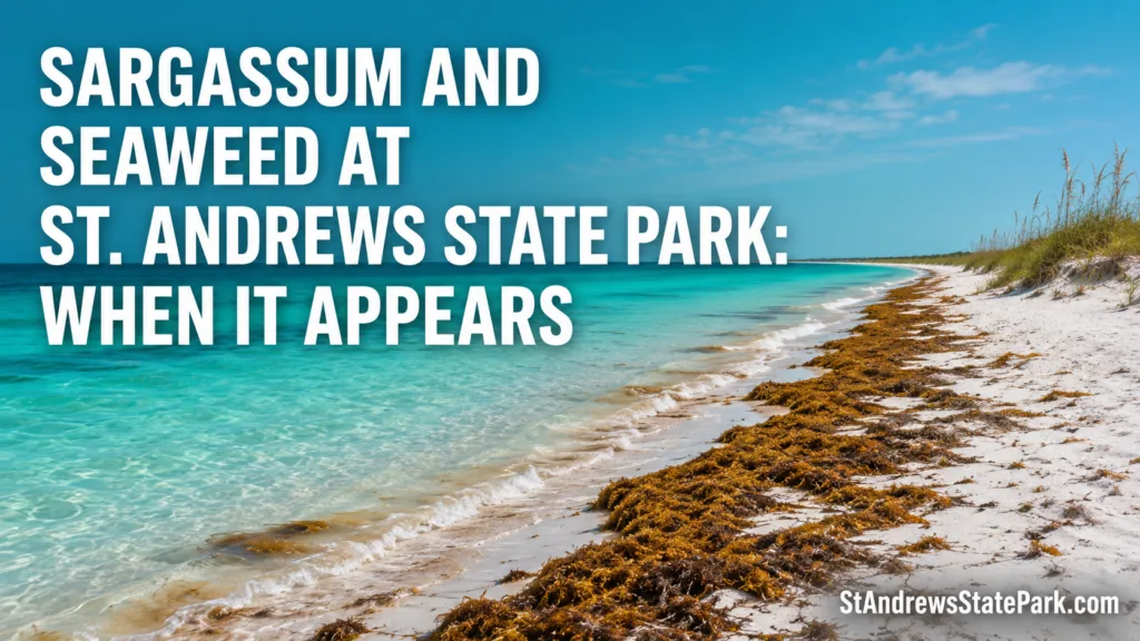
Sargassum does not cover St. Andrews State Park on a fixed schedule. The broad pattern is simple: washed-up brown seaweed becomes more likely from late spring through summer, while winter usually brings fewer large arrivals. The beach can still change overnight. A shift in wind, a stronger surf line, or a high tide can move floating patches onto the sand even when the previous day looked clear.
🌊 The Practical Answer
April through August carries the clearest seasonal chance of sargassum in the Gulf. NOAA describes two main sources that reach the Gulf: a local source that often peaks in April and May, followed by Caribbean material that tends to peak during summer. Whether any of it lands at St. Andrews still depends on local wind, waves, currents, and tide.[a]
When Sargassum Usually Appears
A month can suggest the odds, but it cannot describe the sand on a particular morning. Sargassum travels in scattered patches rather than one solid offshore blanket, and those patches may pass the Florida Panhandle without reaching the beach. Some weeks bring only a thin wrack line. Other periods bring repeated deposits after each tide.
| Time of Year | Typical Pattern | What Visitors May See |
|---|---|---|
| January–March | Usually lower sargassum activity | Small natural wrack lines, storm-tossed seagrass, shells, and drift material |
| April–May | First clear rise in Gulf activity | Scattered floating clumps or fresh brown lines after onshore wind |
| June–August | Most likely period for repeated arrivals | Anything from a few strands to broader mats, depending on local conditions |
| September–October | Still possible, often shaped by rough weather | Mixed wrack after strong surf, high tides, or passing weather systems |
| November–December | Usually declining | Less sargassum overall, though ordinary beach wrack remains possible |
January Through March
Winter is usually the quietest part of the sargassum cycle around the Gulf. That does not mean the shoreline stays empty. Cold fronts can roughen the water and leave behind seagrass blades, driftwood, shells, and small amounts of brown algae. A dark line near the high-tide mark in February may be ordinary wrack rather than the start of a large seasonal arrival.
April and May
Spring is the transition. NOAA identifies a local Gulf source that commonly peaks in April and May, so the first noticeable deposits can appear before the main summer travel season. Some years bring only brief, narrow lines. In others, several days of wind from the water toward shore can produce a more obvious landing.
One early arrival does not predict the whole season. Sargassum may wash in for a day, move along the coast, then disappear after the wind turns. Unsettled, this period can be.
June Through August
Summer brings the highest general chance of visible sargassum. Material moving from the Caribbean can spread into the Gulf during this period, and warm-season wind patterns may push floating patches toward Florida beaches. The amount varies sharply, even within the same month.
A photo from Monday may be useless by Thursday. A small offshore band can remain beyond the surf, slide parallel to the coast, or strand along one section of beach while another section remains mostly open. NOAA notes that the exact timing of beaching cannot be predicted from offshore presence alone.[c]
September Through December
Autumn does not have a clean cutoff date. September can still resemble summer, especially after persistent onshore wind. Later in the year, regional sargassum abundance usually falls, though rough surf may still build a mixed wrack line. By November and December, large sargassum arrivals are generally less common than they are in late spring and summer.
Why the Shoreline Can Change So Fast
Sargassum floats at the surface. It is carried by ocean circulation, then steered near shore by wind, wave direction, current, and tide. Think of the monthly season as the amount of material available offshore; local water movement decides whether that material reaches the sand.
Onshore and Offshore Wind
Wind blowing from the Gulf toward land can bring surface material closer to the beach. Wind blowing from land toward the Gulf may hold it offshore or move fresh strands away from the swim zone. The previous two or three days often matter more than a single hourly reading because a floating patch needs time to travel.
Waves and Tide
Waves break large floating clumps into smaller pieces and carry them through the surf. High tide can place a new brown line farther up the sand; the falling tide then leaves that material behind. The line marks how far water recently reached, not how much seaweed remains offshore.
Rough Weather
After stronger surf, the deposit often contains more than sargassum. Seagrass blades, shells, wood, seeds, and other organic material can arrive together. This mixed band is called beach wrack. It may look heavier because several kinds of natural material have collected in the same place.
🧭 A calendar is a clue, not a beach forecast. For a visit within the next few days, recent wind and surf tell you more than the month alone.
Why Conditions Differ Inside St. Andrews
St. Andrews is not one straight, uniform shoreline. The park management plan counts about 13 miles of combined shoreline along the Gulf, St. Andrew Bay, and Grand Lagoon, including roughly 4.6 miles of Gulf beach. About three quarters of that Gulf beach lies on Shell Island.[b] A report from one section therefore cannot describe every swimming area.
The same plan maps 119.55 acres of marine unconsolidated substrate, the official natural-community term for open sandy marine areas with shells and organic debris. It also records 44 acres of mainland beach dune. These numbers explain why natural shoreline material is part of the park setting rather than an unusual exception.
The Open Gulf Beach
The exposed Gulf side receives direct wave action. Here, sargassum may spread into a long, thin band, break apart in the surf, or gather around small changes in the beach profile. A deposit can be patchy over a surprisingly short distance. Walking farther along the same beach may reveal a clearer entry point.
The jetty and Inlet Lagoon
The rock jetties border the navigation channel and alter water movement near the inlet. Behind the jetty, the protected saltwater area often called the kiddie pool has calmer, shallower water than the open Gulf beach.[d] Small floating strands can sometimes look more noticeable in calm water because waves are not dispersing them. On a different tide, the same area may appear clearer than the surf side. No zone stays consistently seaweed-free.
Grand Lagoon and Shell Island
Grand Lagoon has a more sheltered, estuarine character. Long ribbon-like blades found there may be seagrass rather than pelagic sargassum. Shell Island adds another broad Gulf-facing shoreline, but a mainland observation does not automatically describe the island. Distance, exposure, and water movement all change the pattern.
- Open Gulf side: more direct surf and wave-driven deposits.
- Jetty area: local eddies, rocks, and protected pockets can redistribute floating material.
- Inlet lagoon: calmer water may make small strands easier to see.
- Grand Lagoon side: mixed estuarine plant material is more likely.
- Shell Island: its own long shoreline can differ from the mainland on the same day.
Is It Sargassum or Another Kind of Wrack?
Visitors often call every brown plant on the beach “seaweed,” but not every washed-up blade is sargassum. Knowing the difference helps explain where the material came from and why it looks different from one visit to the next.
How Sargassum Looks
- Bushy, highly branched growth
- Golden-brown, olive-brown, or yellow-brown color
- Small leaf-like blades
- Round, berry-like air sacs that keep it floating
- Tangled clumps rather than long flat ribbons
Those round structures are gas-filled floats, not berries. They allow pelagic sargassum to live at the ocean surface without attaching to the seabed. Floating mats provide habitat for fish, crabs, shrimp, young sea turtles, and other marine life.[e]
How Seagrass Looks
Seagrass usually appears as long, flat, strap-like blades. It may resemble wet lawn clippings or ribbons, sometimes with roots or rhizome fragments attached. Unlike algae, seagrasses are flowering plants that grow rooted in shallow water. Broken blades can drift ashore around the bay, lagoon, and Gulf shoreline.
What Else Sits in the Wrack Line
A natural wrack line may include shells, driftwood, sponge fragments, seeds, seagrass, sargassum, and small marine organisms. Plastic or fishing line can become mixed into it, but those items are litter, not wrack. The natural and human-made material should not be treated as the same thing.
Fresh Sargassum and Older Deposits
Freshly landed sargassum is often lighter in color, damp, and easy to recognize as a branching plant. It may sit at the waterline with little odor. Older deposits become darker, flatter, and more compact as they dry and decompose.
Smell depends on volume, heat, moisture, and time on shore. A thin line can dry with little effect. A deep, wet pile left in warm conditions may develop a strong sulfur-like odor as it breaks down. NOAA notes that large decomposing accumulations can release hydrogen sulfide, which may irritate the eyes or breathing of sensitive visitors.[f] Moving to a cleaner, upwind part of the beach can change the experience quickly because deposits are often local rather than park-wide.
🟤 Sargassum Is Not Red Tide
Sargassum is visible brown macroalgae. Florida red tide is usually associated with the microscopic organism Karenia brevis. A brown plant line on the sand does not prove that red tide is present, and red tide can occur without visible sargassum.[g]
What It Means for Swimming and snorkeling
Light Floating Strands
A few strands usually create more of a texture issue than a swimming barrier. They may brush against legs or collect near the edge of the surf. Clear water can still contain floating sargassum, since the plant itself does not automatically make the water cloudy.
Broader Mats
Thicker patches can make water entry less comfortable and hide the sandy bottom from view. Rather than pushing through a dense band, look for an open gap or another established access point. The mat may end a short distance alongshore. Sometimes abrupt, the boundary is.
Visibility Near the Jetties
For snorkeling, wave action and suspended sand often affect visibility more than a few pieces of seaweed. Calm water with scattered sargassum may remain clear, while a seaweed-free surf zone can look cloudy after rough weather. Current, flags, and water movement still deserve more attention than the plant material alone.
Small Animals in Fresh Mats
Fresh sargassum is a floating habitat, not an empty plant pile. Tiny crabs, shrimp, juvenile fish, and other organisms may shelter among its branches. Children can observe from the edge without digging bare hands into a dense clump. Look closely, then leave the living material where it is.
Why Natural Wrack May Stay on the Beach
A narrow wrack line has a job. It catches windblown sand and seeds, holds moisture, supplies nutrients as it decays, and feeds insects and small crustaceans used by shorebirds. UF/IFAS describes wrack as part of beach and dune resilience, not simply waste on white sand.[h]
The St. Andrews management plan also tells authorized beach drivers to avoid disturbing the wrack line where possible. That detail fits the park’s wider dune management: its sandy shore supports nesting birds, sea turtles, dune plants, and other coastal wildlife. Natural material may therefore remain even when visitors would prefer a perfectly bare line of sand.
This does not mean every large accumulation must stay untouched. Florida agencies may use different management options when sargassum arrives in heavy amounts, including integrating it into the beach, removal, disposal, or composting. The response depends on volume, location, wildlife needs, and local management decisions.
How Long Seaweed May Remain
There is no reliable one-day or three-day rule. A thin overnight line may dry, shift with the next tide, or become partly buried by blowing sand. Repeated onshore wind can replace it with fresh material before the older line disappears.
- One light deposit: may change within hours as the tide turns.
- Several days of arrivals: can make the beach look unchanged even though new material keeps replacing old material.
- A thick sheltered pile: may remain longer because waves cannot easily redistribute it.
- Rough-weather wrack: may contain heavier seagrass and wood that stay after loose sargassum has moved.
Watch the pattern, not just the pile. Fresh golden pieces at the waterline suggest a current arrival. Dark compact material higher on the beach usually points to an older tide line.
Reading Conditions Before a Visit
For a trip several weeks away, the season is the only honest clue. For a trip tomorrow, recent local conditions matter more. No regional satellite map can promise a clear strip of sand at one park access point.
- Review the wind direction over the previous 24–72 hours, not only the current hour.
- Look for recent images that clearly show the date and the exact park zone.
- Check whether rough surf or unusually high water recently crossed the beach.
- Compare the open Gulf side with the jetty lagoon rather than assuming both match.
- Ask park staff about the mainland Gulf beach, jetty area, and lagoon separately.
- Use NOAA’s regional Sargassum Inundation Risk product as context, not as a guarantee for one shoreline.
Social posts need the same caution. A close-up of one dense clump can make a long beach appear covered, while a wide photo may hide a narrow band at the waterline. Date, location, and camera angle matter.
What a Seaweed Day Can Look Like
Light Arrival
A narrow brown line, a few floating pieces, little odor, and plenty of open sand. Swimming conditions depend more on surf and flags than on the seaweed.
Moderate Arrival
Intermittent bands in shallow water, thicker patches near certain access points, and clearer gaps farther along the shoreline.
Heavy Arrival
Broad mats, repeated deposits, darker older piles, and a stronger odor in warm weather. Another park zone may still look different.
For visitors trying to avoid seaweed, winter offers the lowest general probability, while late spring and summer carry the highest. Yet the useful decision is often smaller than choosing a month: choose the clearer part of the park on the day you arrive. At St. Andrews, shoreline variety works in the visitor’s favor.
Sources and Verification
- NOAA CoastWatch: Sargassum FAQ — explains Gulf seasonal sources and the role of wind, waves, currents, and tide in beaching. (NOAA is the United States federal ocean and atmosphere science agency.)
- Florida DEP: St. Andrews State Park Approved Management Plan — provides park shoreline lengths, natural-community acreage, jetty context, dune information, and wrack-line management details. (Florida DEP is the state agency responsible for Florida State Parks planning and environmental management.)
- NOAA NESDIS: Sargassum Detection and Monitoring From Space — documents the broad rise toward summer and decline through fall and winter. (NESDIS operates federal environmental satellite and data programs.)
- Florida State Parks: Beaches at St. Andrews — confirms the mainland beach, boardwalk access, protected saltwater lagoon, barrier-island setting, and beach wildlife. (This is the official visitor information service for Florida State Parks.)
- Florida Fish and Wildlife Conservation Commission: Sargassum Bloom — explains pelagic sargassum, annual spring and summer abundance, floating habitat, and Florida monitoring. (FWC is Florida’s state wildlife research and management authority.)
- NOAA Ocean Service: Sargassum From Sea to Shore — describes shoreline accumulation, decomposition, odor, and hydrogen sulfide concerns during heavy events. (NOAA Ocean Service is a federal coastal science and management authority.)
- NOAA NCCOS: Gulf Coast Harmful Algal Bloom Forecast — identifies Florida red tide as a bloom associated with microscopic Karenia brevis. (NCCOS is NOAA’s coastal science center for harmful algal bloom monitoring and forecasting.)
- UF/IFAS: Dune Restoration and Enhancement for the Florida Panhandle — explains beach wrack, wildlife use, nutrient cycling, seed capture, and dune development. (UF/IFAS is the University of Florida’s research and extension system.)
Frequently Asked Questions
What months are most likely to have sargassum at St. Andrews State Park?
Late spring and summer carry the highest general chance, especially from April through August. Large arrivals are less common in winter, but no month guarantees a bare shoreline.
Is seaweed present every day during summer?
No. Offshore patches can pass without landing, and local wind, waves, currents, and tide can change the beach within hours or days.
Which part of St. Andrews usually has the least seaweed?
There is no permanently cleaner zone. The open Gulf beach, jetty lagoon, Grand Lagoon shoreline, and Shell Island can show different conditions on the same day, so comparing areas after arrival is more reliable than choosing one in advance.
Is the brown material always sargassum?
No. Long ribbon-like blades are often seagrass, while natural wrack may also contain shells, seeds, wood, sponge fragments, and other organic material.
Does sargassum mean red tide is present?
No. Sargassum is visible brown macroalgae. Florida red tide is generally associated with microscopic Karenia brevis, so the two conditions must be checked separately.
How long does washed-up seaweed stay on the beach?
A thin line may move or dry within hours, while repeated arrivals or thick piles in sheltered spots may remain for several days. There is no fixed removal or disappearance time.
Can people swim when sargassum is present?
Light strands often do not block swimming, although some visitors dislike the texture. Dense mats can make entry uncomfortable, and strong odor from a large decomposing pile is a reason to choose a cleaner, upwind section.