St. Andrews State Park still offers a full park experience when swimming is not part of the day. The mainland has short nature trails, marsh and lake overlooks, fixed fishing piers, paved-road cycling, picnic areas, historic gun mounts, wildlife viewing, and a boat trip that does not require entering the water. The useful question is not simply, “Can you swim?” It is how close to the water you feel comfortable being.
A visitor who wants to remain on dry ground can spend time in the flatwoods, scrub, basin marsh, and lakeside habitats. Someone comfortable beside the shoreline can add the jetty overlook, pier fishing, and beach walking. The Shell Island ferry forms a third category: no swimming is required, but the outing takes place by boat.
🌲 Fully dry: Heron Pond Trail, geocaching, paved-road cycling, historic sites, and inland picnic areas.
👀 Water view without entering: Gator Lake Overlook, Buttonbush Marsh Overlook, fishing piers, the jetty overlook, and shoreline photography.
⛴ Boat-based: The official Shell Island ferry. Swimming remains optional, though passengers should be comfortable boarding and riding a vessel.
Activities That Fit Different Comfort Levels
| Activity | Water Contact | Typical Surface | Best Fit |
|---|---|---|---|
| Heron Pond Trail | None | Natural trail | Forest scenery and a short walk |
| Gator Lake Trail and Overlook | None when staying on the trail | Natural trail and overlook | Alligators, waterfowl, and lakeside views |
| Buttonbush Marsh Overlook | None | Roadside overlook | Herons, ibis, and marsh activity |
| Fishing Piers | No planned contact | Fixed pier | Fishing without a boat |
| Park-Road Cycling | None | Paved roadway | Moving between several use areas |
| Geocaching | Usually none | Varies by approved cache location | Families and GPS-based exploration |
| Jetty Overlook | No planned contact | Boardwalk and overlook | Channel views, history, and photography |
| Shell Island Ferry | No swimming required | Boat, dock, and sand | Visitors comfortable on a vessel |
The park’s current visitor information lists hiking, bicycling, fishing, geo-seeking, picnicking, wildlife viewing, camping, and boat tours alongside its water sports. It also identifies elevated boardwalks, two fishing piers, accessible overlooks at Gator Lake and Buttonbush Marsh, and beach wheelchairs available by asking at the ranger station.[a]
Why the Park Works Without Swimming
The shoreline gets most of the attention, yet much of the park’s variety sits behind it. The approved 2016 management plan mapped 14 natural communities. At the time of that plan, the mapped land included 276.46 acres of scrub, 233.65 acres of mesic flatwoods, 161.10 acres of beach dune, 90.82 acres of basin marsh, and 68.55 acres of salt marsh. Those numbers explain why a non-swimming visit does not feel like waiting beside a beach.
Each habitat changes what can be seen from land. Flatwoods bring tall pines and palmettos. Basin marsh supports wading birds and freshwater wildlife. Scrub has low, wind-shaped vegetation adapted to sandy soil. Dune walkovers open broad coastal views while keeping foot traffic away from sensitive plants.[b]
🌿 Habitat matters: Stay on marked paths, boardwalks, and overlooks. A shortcut through scrub or dunes may look harmless, but sandy plant communities are easily worn into informal trails.
Gator Lake Trail and Overlook
Gator Lake is the clearest choice for visitors who want wildlife viewing without a long hike. The current park page describes Gator Lake Trail as one of two half-mile trails and notes its scenic lakeside view. The overlook provides a defined place to watch the water rather than approaching the shoreline.
American alligators may be seen in the lake or along the marsh edge. Waterfowl and wading birds also use the area. The better view often comes from waiting quietly: an alligator’s eyes and snout may break the surface, while herons work the shallows with slow, measured steps.
Using the Overlook
- Remain on the marked trail and viewing structure.
- Use binoculars or a zoom lens instead of moving closer to wildlife.
- Keep food packed away and never feed animals.
- Allow extra space when wildlife is visible near a path or road edge.
This is a viewing area, not a waterside play area. That distinction makes it useful for non-swimmers: the experience comes from observation, not contact with the lake.
Heron Pond Trail Through the Flatwoods
Heron Pond Trail offers a different scene. Rather than following a lake edge, it passes through flatwood pine forest toward Sandy Point. The park currently describes it as a half-mile trail, making it a manageable choice for visitors who want a short nature walk rather than a beach-centered outing.
The appeal is in the transition. Pine trunks rise over palmetto and low vegetation, then the landscape begins to open toward the coastal side of the park. Listen as much as you look. Bird calls, wind in the pines, and movement in the understory often reveal more than a fast walk does.
Gator Lake or Heron Pond?
| Choose Gator Lake For | Choose Heron Pond For |
|---|---|
| A defined wildlife overlook | A pine-forest walk |
| Alligator and waterfowl viewing | Flatwoods plants and woodland birds |
| A lakeside setting | Less focus on open water |
| Visitors who prefer to pause and observe | Visitors who prefer steady walking |
For someone uneasy around open water, Heron Pond usually feels more removed from the shoreline. Gator Lake is better for wildlife watchers who are comfortable viewing freshwater from a protected position.
Buttonbush Marsh and Dry-Land Birding
Buttonbush Marsh Overlook deserves its own stop. It is not simply a smaller version of Gator Lake. The marsh supports a different feeding pattern, with herons and ibis working the edge while ducks and other waterfowl use the open sections.
A dry-land birding route can connect Gator Lake, Buttonbush Marsh, the pine interior, and the jetty overlook. The habitat changes over a relatively compact area, so the bird mix changes too. Wading birds favor marsh edges. Raptors may use exposed perches. Migratory birds pass through the wooded interior and coastal vegetation.
- Bring binoculars: 8x magnification is easy to hold for general birding.
- Scan before walking on: Still birds blend into marsh vegetation.
- Watch posted boundaries: Resting and nesting areas need space.
- Keep the volume low: Quiet observation often produces longer views.
Fishing Without a Boat
St. Andrews has fixed fishing locations for visitors who prefer to remain on land. The park lists two fishing piers, along with surf and jetty fishing. A pier provides a more predictable standing surface than the outer jetty rocks, which can be uneven and wet.
Choosing a Fishing Position
- Grand Lagoon pier: A land-connected option near the boat basin and picnic facilities.
- Gulf-side pier: Open coastal views with no need to board a vessel.
- Surf fishing: Possible from the sand, though casting can be done without wading.
- Jetty rocks: Better left to visitors who are steady on irregular surfaces and comfortable close to moving water.
The park names Spanish mackerel, redfish, flounder, sea trout, bonito, cobia, and bluefish among possible catches. Species, seasons, size limits, and harvest rules vary, so the catch list is never a promise.
🎣 License check: Florida requires the proper saltwater license unless an exemption applies. A shoreline-only license has limits, especially when a fishing location is reached by vessel. Review the current Florida Fish and Wildlife Conservation Commission rules before bringing tackle.[c]
Cycling Between Park Areas
A bicycle turns the park road into a connecting route between overlooks, picnic areas, the campground vicinity, stores, and shoreline viewpoints. It works well for non-swimmers who want to see more than one section without repeatedly moving a car.
Bicycles are limited to roadways. They are not permitted on footpaths, boardwalks, or the trail leading to the beach. That rule keeps the walking routes clear and protects narrow natural areas. Walk the Gator Lake and Heron Pond trails; ride between them.
Heat and road traffic shape the experience. Earlier hours often feel more comfortable, and a helmet, water bottle, and visible clothing make sense even on a casual ride. Rental availability can change with concession schedules, so visitors relying on a rental should confirm it before arrival.
Geocaching Without Disturbing Habitat
Geo-seeking gives a walk a purpose beyond reaching a viewpoint. Participants use GPS coordinates to locate approved caches, turning the park into a low-impact search area. Some finds are simple; others require careful observation.
The search should never become an excuse to cross a dune, push through protected vegetation, or create a new track through scrub. If a route appears to conflict with a sign, closure, or marked boundary, the boundary wins. Cache information can also change, so check current coordinates before entering the park.
For families with children, geocaching can make a short dry-land walk feel more active without adding a water-based activity. For adults, it encourages attention to small landscape details that are easy to miss from a car.
The Jetty Overlook as a Viewing Area
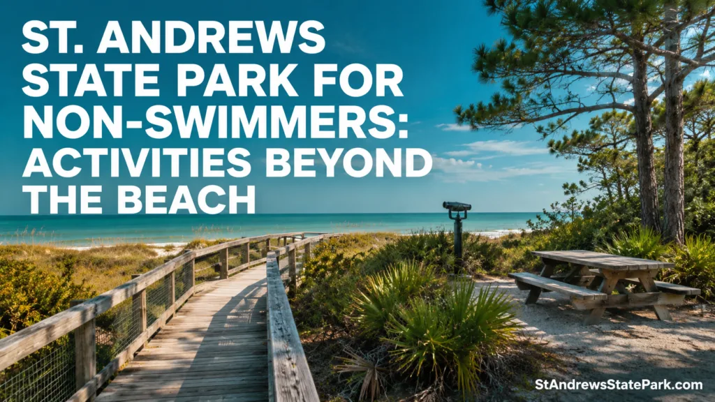
The jetty area is often described through snorkeling and swimming, but the elevated overlook and boardwalk also work as a shore-based destination. From here, visitors can watch boats move through the pass, observe anglers, scan for birds, study the rock structure, and photograph changing light over the water.
The overlook is also known as the Gun Mount. In 1942, the site became a temporary harbor-defense installation with two 155 mm guns positioned near the pass. One original mount stands at the jetty overlook; the other is on the Gulf side of the jetty beach area.[d]
There is no need to climb onto the outer rocks to understand the setting. The boardwalk and overlook provide the broader view with firmer footing. For a non-swimmer, that is the better distinction: visit the jetties as a landscape and historic site, not as an invitation to move closer to the channel.
Shell Island Without a Swimming Plan
Shell Island can be visited without swimming. The official ferry leaves from the park system, and a tram ride begins at the Pier Store before passengers reach the marina. The island itself is accessible only by boat, so this choice suits visitors who are comfortable boarding, riding, and leaving a vessel at a dock or landing area.[e]
What to Do on the Island
- Walk the firm section of shoreline without entering the water.
- Observe seabirds from outside posted nesting areas.
- Study dune shapes, sea oats, wrack lines, and changing sand textures.
- Photograph the pass, mainland, and undeveloped coastal landscape.
- Sit above the normal wash line and treat the visit as a nature stop rather than a swim trip.
When the Ferry Is Not the Right Choice
A ferry outing still places the visitor on the water. Someone who feels uneasy on boats, has difficulty with boarding surfaces, or wants immediate access to a car may prefer mainland activities. The island is largely undeveloped, so shade, seating, and restroom access should be checked before committing to the trip.
Ferry service is seasonal and operating details can move with weather, demand, and concession schedules. Confirm the departure process and return times on the day of the visit.
Picnic Areas With Different Views
The park identifies three main picnic settings: the jetties use area, Gulf pier use area, and boat basin. They are not interchangeable.
- Jetties use area: Best for watching activity near the pass and pairing lunch with the gun-mount overlook.
- Gulf pier use area: Suits visitors who want an open coastal view while remaining out of the water.
- Boat basin: A practical match for pier fishing, playground use, and watching boats in Grand Lagoon.
The boat-basin setting often works well for mixed groups. One person can fish, another can use the picnic facilities, and children can use the nearby playground. Nobody has to treat swimming as the main event.
Staying Overnight for Land-Based Activities
The campground can serve as a base for early wildlife watching, short trail walks, cycling, fishing, and evening views. Current park information says most campsites face Lower Grand Lagoon and include water, 30- and 50-amp electrical service, sewer connections, a picnic table, and a grill.
Glamping eco-tents add another option for visitors who do not own camping equipment. Each tent has a water view and includes electricity, a queen bed, and a twin-size cot. The view is coastal; the stay does not require a water activity.
Campground work and site availability can change. Check the current reservation page rather than relying on an older campground map.
Activities That Still Carry Water Exposure
Not every activity described as an alternative to swimming is truly dry. kayaking and paddleboarding take place on the water. A person may not plan to swim, yet a capsize or fall can still put them in the water. A properly fitted life jacket is basic equipment, not a substitute for comfort around open water.
Wading is another poor match for someone trying to avoid water exposure. Shallow appearance does not guarantee steady footing, a flat bottom, or the same depth several steps ahead. The same caution applies to wet jetty rocks.
| Activity | Dry-Land Choice? | Reason |
|---|---|---|
| Boardwalk and jetty overlook | Yes | Designed viewing surface with no need to enter the water |
| Fixed fishing pier | Yes, with normal waterside care | Land-connected structure |
| Shell Island ferry | No | Boat travel is required |
| Kayak or paddleboard | No | Falling into the water remains possible |
| Wading | No | Direct water contact and changing footing |
| Outer jetty rocks | No | Uneven surface close to moving water |
Planning for a Mixed Group
Groups often include swimmers and non-swimmers. The day works better when the person staying dry has a real activity rather than being assigned to watch bags.
- Choose a named meeting place such as the jetty overlook, Gulf pier picnic area, or boat basin.
- Set a meeting time rather than depending on phone service near the shoreline.
- Keep car keys, medication, water, and sun protection with the person who needs them.
- Pair swimming time with a nearby land activity: pier fishing, photography, birding, a boardwalk visit, or a picnic.
- Do not split ferry passengers from mainland visitors without agreeing on the return schedule.
The park is open from 8 a.m. until sundown, 365 days a year. Current admission details and special service hours can change, so confirm them before setting a meeting plan around opening, ferry, rental, or store times.[f]
Sources and Park Records
- Florida State Parks — St. Andrews Experiences and Amenities — current activity, trail, accessibility, fishing-pier, picnic, bicycle, and wildlife-viewing information. (Official Florida State Parks page.)
- Florida Department of Environmental Protection — St. Andrews State Park Approved Management Plan — mapped natural communities, habitat acreage, land-use records, and park facility data. (Approved state land-management document.)
- Florida Fish and Wildlife Conservation Commission — Recreational Saltwater Licenses and Permits — license types, shoreline limits, exemptions, and permit requirements. (State wildlife and fishing regulator.)
- Florida State Parks — St. Andrews State Park History — gun mounts, Gulf-Bay Pass, Shell Island formation, and Teddy the Hermit. (Official park history record.)
- Florida State Parks — Shell Island Adventures — official ferry access, tram boarding point, retail services, and eco-tent information. (Official state park service page.)
- Florida State Parks — Hours and Fees — current opening hours, admission charges, and arrival information. (Official operating-information page.)
Questions About Visiting Without Swimming
Is St. Andrews State Park worth visiting if I cannot swim?
Yes. The park has two short nature trails, wildlife overlooks, two fishing piers, picnic areas, paved-road cycling, geocaching, historic gun mounts, camping, birding, and boardwalk views. A visitor can build the day entirely around land-based activities.
Which trail is better for someone who wants less open water?
Heron Pond Trail is the stronger choice because it passes through flatwood pine forest toward Sandy Point. Gator Lake Trail is better for visitors comfortable viewing a freshwater lake from a marked trail and overlook.
Can I fish at St. Andrews without using a boat?
Yes. The park offers fixed fishing piers, surf fishing, and jetty fishing. Non-swimmers may find the piers more comfortable than uneven outer jetty rocks. Current Florida license and harvest rules still apply.
Can a non-swimmer take the Shell Island ferry?
Swimming is not required, but the trip involves boarding a ferry and spending time on a boat-access-only island. It suits non-swimmers who are comfortable on vessels and can manage the boarding surfaces and return schedule.
Is kayaking a dry alternative to swimming?
No. Kayaking does not require swimming as the planned activity, but it still takes place on open water and a paddler can fall or capsize. Visitors seeking no water exposure should choose trails, overlooks, piers, cycling, geocaching, or picnic areas instead.
Are there accessible viewing areas for non-swimmers?
The park lists elevated boardwalks, a jetty overlook, overlooks at Gator Lake and Buttonbush Marsh, two fishing piers, accessible picnic facilities, and beach wheelchairs available by inquiry at the ranger station. Current availability should be confirmed before arrival.