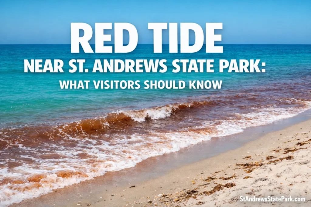
Red tide near St. Andrews State Park is not something visitors should treat as a vague rumor or a one-line beach update. At this park, location matters, wind matters, and even the difference between the bay side and the Gulf-facing shoreline can change what a visitor actually experiences. That is what makes this place so interesting. St. Andrews State Park is a large, ecologically layered coastal park with mainland beaches, Shell Island access, Grand Lagoon frontage, dunes, marsh, and seagrass nearby, so the smartest way to understand red tide here is through official sampling data, local geography, and real health guidance rather than guesswork.[a]
🟢 As of the Florida Fish and Wildlife Conservation Commission update dated March 6, 2026, Bay County was in the background category for Karenia brevis. In the same update, FWC reported no fish kills and no respiratory irritation suspected to be related to red tide over the previous week. Background means 1,000 cells per liter or less, with no effects anticipated. Still, red tide is famously patchy, so a county-level update is a starting point, not a guarantee for every stretch of shoreline inside the park.[c]
What The Official Data Says About This Park
| Local Measure | Official Figure | Why It Matters For Red Tide |
|---|---|---|
| Park Acreage In The 2016 Management Plan | 1,167 acres | A large coastal footprint means conditions do not always feel uniform from one access area to another. |
| Shell Island Portion | 690-acre undeveloped barrier island | The park is not just one beach. Mainland, island, pass, and bay waters create different on-the-ground experiences. |
| Natural Communities | 14 distinct communities | Visitors are moving through a real coastal ecosystem, not a simple resort shoreline. |
| Campground Capacity | 176 sites and 4 bathhouses | Heavy visitor use makes daily monitoring far more important than casual assumptions. |
| Recorded Visitation | 1,011,837 visitors in FY 2014/2015 | When a park draws this many people, even low-level water quality changes matter for trip planning. |
| Estimated Direct Economic Impact | More than $88 million and 1,408 jobs in FY 2014/2015 | Red tide is also a visitor-information issue, not only an ecological one. |
Those figures help explain why red tide near St. Andrews State Park deserves a more careful reading than a generic “beach conditions” note. The official park plan describes a place at the meeting point of St. Andrew Bay and the open Gulf coast, with mainland facilities, Shell Island landings, a campground, fishing areas, and shoreline habitats that support both recreation and wildlife. In plain terms, this is the kind of park where one report can affect many different kinds of visitors at once.[a]
What Red Tide Actually Is
Florida red tide is most closely associated with Karenia brevis, a microscopic marine alga that occurs naturally in Gulf waters. FWC notes that background concentrations are 1,000 cells per liter or less. Each cell is typically 20 to 45 micrometers long and 10 to 15 micrometers deep, and the organism can move through the water at roughly one meter per hour. It tends to do well in high-salinity water, which is one reason it matters so much along exposed coastal areas and salty estuarine zones.[b]
🧪 How Agencies Describe Red Tide Levels
- Background: 1,000 cells/L or less — no effects anticipated.
- Very Low: more than 1,000 to 10,000 cells/L — respiratory irritation and shellfish harvest closures are possible.
- Low: more than 10,000 to 100,000 cells/L — respiratory irritation becomes more likely, and fish kills can occur.
- Bloom Concentration: more than 100,000 cells/L — environmental and health impacts become increasingly likely.
That framework matters because a headline that simply says “red tide” does not tell you enough. The concentration category changes what visitors should reasonably expect on the sand, in the water, and even in the air.[c][e]
Why St. Andrews State Park Needs A Local Reading
🌬️ One Shoreline Can Feel Different From Another
This is one of the biggest points visitors often miss. Red tide is patchy. NOAA notes that harmful algal blooms are usually isolated patches moved by winds and currents, and that impacts vary by location and even through the day. NOAA also explains that when surf or breaking waves release toxins into the air, onshore winds can push irritation toward the beach, while offshore winds can reduce it. That matters at St. Andrews because the park includes exposed Gulf shoreline, a pass area, bay waters, lagoon access, and boat routes to Shell Island. In other words, red tide here behaves less like a simple switch and more like weather over water.[g]
🌿 This Is A Sensitive Estuarine System, Not Just A Beach
The park’s own management plan gives useful ecological context. It states that the St. Andrew Bay ecosystem supports more than 3,600 species. It also identifies three seagrass species in the bay — turtlegrass, shoal grass, and manatee grass — with turtlegrass described as the dominant seagrass and typically growing in depths of 1.8 to 2.4 meters. The natural communities map in the same plan lists just 1.01 acre of estuarine seagrass bed within the park boundary, which shows how small mapped habitat areas can still sit inside a much larger, biologically rich coastal system.[a]
That ecological detail is worth keeping in mind when reading any red tide near St. Andrews State Park report. Visitors are not only stepping onto sand. They are entering a landscape of dunes, salt marsh, seagrass, bird habitat, and high-use shoreline. The park plan even notes that damage to shallow seagrass from propeller scars can take years to recover, which is a reminder that water-quality conversations here are connected to a broader habitat story.[a]
📍 Recent Local Context Matters
A useful recent example came from the Florida Department of Health in Bay County. On October 28, 2025, DOH-Bay advised the public to use caution because of red tide in St. Andrews Bay near Flower Avenue and the Hathaway Bridge, based on water samples taken on October 24. That advisory did not mean every access point in the wider St. Andrews area would feel identical, but it did show that the broader bay system can register detectable conditions and health messaging when sampling warrants it.[d]
🧭 The practical takeaway: a Bay County red tide update should prompt a check of the latest map, not an automatic assumption that every part of the park, every beach pocket, and every boat landing will feel the same that day. That one distinction answers a lot of the confusion visitors run into.[c][g]
How To Read Today’s Conditions Before You Visit
- Check the FWC statewide status page for the latest weekly interpretation and county-level context.
- Use the daily sample map when you want fresher location-by-location detail. FWC says that map reflects the last eight days of sampling and is updated daily at 5 p.m.
- Use Protecting Florida Together if you want the state dashboard version. Florida says the red tide data shown there are identical to daily sample data on the FWC site.
- Read the concentration level, not just the label. “Background,” “very low,” and “low” do not mean the same thing for beach comfort, seafood decisions, or sensitive visitors.
That last point deserves emphasis. A visitor who sees background in Bay County is reading a very different situation from someone seeing low concentrations on an exposed stretch of coast with onshore wind. The label is not decoration. It is the key to understanding what the day may actually feel like.[c][e]
Health And Seafood Guidance Visitors Should Not Skip
🩺 Exposure Guidance
- Do not swim or wade in or around red tide.
- Wash skin and clothing with soap and fresh water after contact.
- Respiratory symptoms can include coughing, sneezing, eye irritation, and throat irritation.
- Air-conditioned indoor space can help relieve symptoms for many people.
- People with asthma, emphysema, bronchitis, or other chronic lung conditions should be especially cautious.
🐚 Seafood Guidance
- Do not harvest or eat distressed or dead fish from or near a red tide area.
- Live, healthy fish can be eaten if filleted and rinsed thoroughly with fresh water.
- Do not harvest or eat molluscan shellfish or marine gastropods from affected areas.
- Shellfish can concentrate brevetoxins, and contaminated shellfish can cause neurotoxic shellfish poisoning.
Florida health guidance is straightforward, and it is worth following closely. Red tide can irritate skin, eyes, nose, and throat, and the irritation can feel stronger when winds are onshore. Shellfish deserve extra caution because they can concentrate toxins. That is why experienced visitors check both the red tide map and the current shellfish harvesting status rather than relying on memory or last week’s conditions.[f][g]
Why This Topic Is Bigger Than A Single Beach Day
St. Andrews State Park is one of those places where the scenery can make people forget the science for a moment. White sand, clear-looking water, jetties, boat traffic, Shell Island runs, campground loops, fishing access — it all feels easy. Yet the official records show a park that is also large, heavily visited, and tied to a biologically rich estuarine system. That is why accurate red tide interpretation matters here so much. It protects trip decisions, helps visitors read conditions more intelligently, and fits the park better than vague beach chatter ever could.[a][c]
Frequently Asked Questions
Is There Red Tide Near St. Andrews State Park Right Now?
According to FWC’s March 6, 2026 update, Bay County was in the background category for Karenia brevis, which means 1,000 cells per liter or less and no effects anticipated. Conditions can still shift, so visitors should check the latest official daily map before heading out.[c]
Does A Bay County Detection Mean Every Part Of The Park Will Feel The Same?
No. Red tide is patchy, and NOAA says impacts vary by location, winds, currents, and even the time of day. At St. Andrews, mainland shoreline, the pass, bay side waters, and Shell Island access areas can produce different visitor experiences.[g]
Which Side Of The Park Is More Likely To Feel Respiratory Irritation?
When red tide is present, areas with breaking surf and onshore winds are more likely to produce airborne irritation. NOAA notes that offshore winds can reduce those effects. That is one reason exposed Gulf-facing shoreline can feel different from more sheltered water on the same day.[g]
Can Visitors Swim During Red Tide?
Florida health guidance says do not swim or wade in or around red tide because it can cause skin irritation, rashes, and burning or sore eyes. If contact happens, wash off with soap and fresh water.[f]
Is It Safe To Eat Fish Or Shellfish From The Area?
Live, healthy fish can generally be eaten if filleted and rinsed thoroughly with fresh water, but visitors should not harvest or eat distressed or dead fish. Shellfish require more caution because they can concentrate brevetoxins. Florida health officials advise against harvesting or eating molluscan shellfish or marine gastropods from affected areas.[f]
What Is The Best Official Source To Check Before Visiting?
The safest routine is to check the FWC red tide status page, then use the daily sampling map for fresh location detail. The state’s Protecting Florida Together dashboard is also useful because Florida says the red tide data shown there are identical to daily sample data on the FWC site.[c][e]
Sources
- [a] Florida Department of Environmental Protection — St. Andrews State Park Approved Unit Management Plan (PDF) — Used for park acreage, Shell Island size, visitation, campground capacity, Gulf pier length, natural communities, seagrass details, and habitat context for St. Andrew Bay. (Reliable because it is an official state park management document.)
- [b] Florida Fish and Wildlife Conservation Commission — About Red Tides in Florida — Used for the biology of Karenia brevis, including background levels, cell size, movement, and salinity context. (Reliable because it is the state wildlife agency’s red tide science page.)
- [c] Florida Fish and Wildlife Conservation Commission — Red Tide Current Status — Used for the March 6, 2026 Bay County status, the background definition, fish kill reporting, respiratory irritation notes, and daily map update timing. (Reliable because it is the state’s official current red tide status page.)
- [d] Florida Department of Health In Bay County — DOH-Bay Cautions About Red Tide In St. Andrews Bay — Used for the October 28, 2025 local caution notice tied to St. Andrews Bay near Flower Avenue and Hathaway Bridge. (Reliable because it is the county health department’s official public notice.)
- [e] Protecting Florida Together — Water Quality Status Dashboard — Used for Florida’s red tide concentration language and the note that dashboard data match FWC daily sample data. (Reliable because it is a Florida government water-quality platform using state agency data.)
- [f] Florida Department of Health — Harmful Algal Blooms — Used for swimming, exposure, symptom, fish, and shellfish guidance. (Reliable because it is statewide public health guidance from Florida’s health department.)
- [g] NOAA National Centers For Coastal Ocean Science — Gulf Coast Harmful Algal Bloom FAQs — Used for the patchy nature of blooms, the role of surf and wind in airborne irritation, and why offshore winds can reduce beach effects. (Reliable because it is a NOAA science resource focused on harmful algal bloom forecasting.)